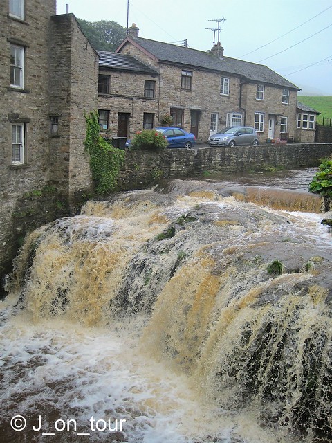
The Waterfalls walk is a 4.5miles (8km) well trodden path, triangular shaped route on a private land path that has been popular with people since Victorian times.
On leaving the town of Hawes, the weather improved marginally enough to press on with our journey towards the previously mentioned Ribblehead viaduct. Although I had been down this road twice before, I didn't realise the serious height gain on the road as we climbed slowly up the hill. This was made more noticeable by the low lying cloud that we had entered !! We had hoped to see the summit of Whernside at one stage but I gave up that idea rather quickly because on reaching Ribblehead, we couldn't even see the viaduct far less the mountain behind it.
For those who don't know what to look out for, you have a far better idea of the view than my fellow passengers who still don't know what this view looks like......
 |
Whernside and Ribblehead viaduct in happier times !! .... 13th May 2010
|
I had a reserve walk option up my sleeve of something a bit lower, less exposed, scenic and possibly worthwhile considering the amount of rain in the last few days at Ingleton. Apologies to the hardened walkers out there reading this..... yes, I know.......the last time I did this walk was when I took my Mother for a long day out in the car many years ago.
I knew that there might be an entrance fee into the grounds but unfortunately it was a long time ago and it was a bit difficult to accept that it was going to cost £18.
The ticket salesman did mention that we had free parking, but he couldn't understand the argument that it would cost the same if we had arrived in four cars.
After putting on our boots and setting out on the walk, we came across a tree that was filled with two pence pieces.....
It seems to be a long standing tradition that people place small amounts of money in certain specified tree trunks as either a good luck charm or a wish. I was wishing that the weather had been better & thinking..... I wonder what the gatekeeper does with all his small coins from the entrance fees !!
The first section of the walk follows the course of the River Twiss with several smaller waterfalls gradually gaining height towards the main falls of Thornton Force (title photo)
 |
| Over the edge.... for Thornton Force ! |
 |
| no medals for this performance, wrong pool... kayaks only |
My fellow walkers decided that it was just as wet outside the water as it was in, so they threatened to dive in !!
We eventually reached the top of the hill and crossed the river. The remaining member of my group is spotted on the bridge trying to capture an illusive photograph before me. I was going to leave this photo out as I spent a lot of time with the four image options I collected. I quite liked the angles of the posts, tried several variations but wasn't happy with the result with no-one on the bridge. I haven't had time to ask for permission to publish this yet, my friend has become faceless, sorry to him!!
 |
| vanishing point... well, not quite ! |
The middle section of the walk was along a mixture of farmland tracks and paths amongst the low clouds
We came across a selection of gates both old and new near White Scar caves. Welcome to weather........
The last section back to the car park followed the course of the River Doe with numerous smaller falls and a gorge
Lastly, even though the walk was only 4.5 miles long, the rain started again and it seemed like a long time before we arrived in Ingleton. You know it's a bad sign when a dog keeps an eye on the weather !! .
...... well, there was no space in the tree for my coins, I've saved them for a hot drink.. (to be continued !)


